The Platform
Vortex Viewer is a PyQt6 + WebGL2 workstation that stitches NEXRAD radar, NWP models, severe weather intelligence, AI narration, and broadcast graphics into a single operator interface.
Live Radar
Vortex Viewer pulls anonymous Level II and Level III data straight from AWS S3 and renders raw polar bins on a WebGL2 GPU-instanced pipeline — no PNG rasterization, no quality loss.
VortexView 3D
VortexView 3D is a from-scratch WebGL2 volumetric renderer that turns reflectivity data into billowing, self-shadowed storm clouds — complete with wall clouds, tornado funnels, and precipitation shafts.
Vortex AI
Powered by the Claude API and a meteorology-aware system prompt, Vortex AI captures your radar scene, interprets the data, focuses the map on the storm it's discussing, and speaks it in a natural broadcast voice.
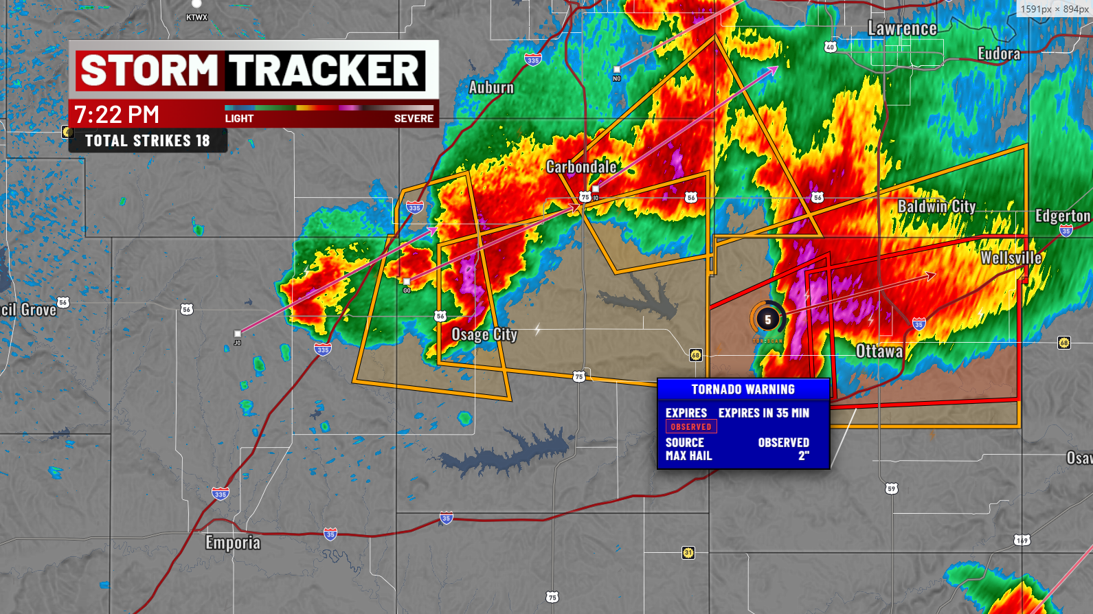
Severe Weather Intelligence
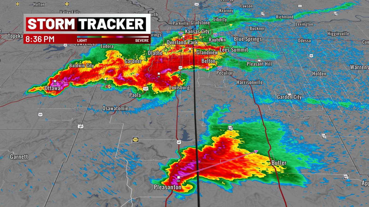
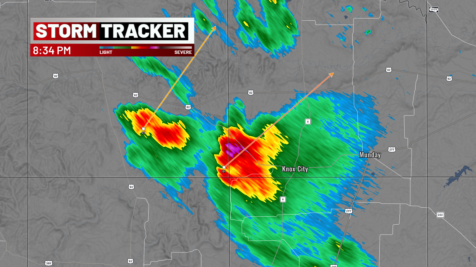
Storm Cell Identification & Tracking with dBZ, VIL, MESH, POH, POSH, TVS, MESO attributes. Storm motion projection lines, past tracks, forecast tracks, arrowhead tips, Baron-style click popups.
Mesocyclone Detection Algorithm. PNG spinning ring markers — red for low-level, yellow for elevated — with zoom-adaptive sizing and click-to-open shear info panels.
Tornado Vortex Signature rendered as a WebGL ring overlay with rotation strength data surfaced in the popup panel.
Hail Index with probable / positive hail triangle markers plus MESH labels for instant severity scanning.
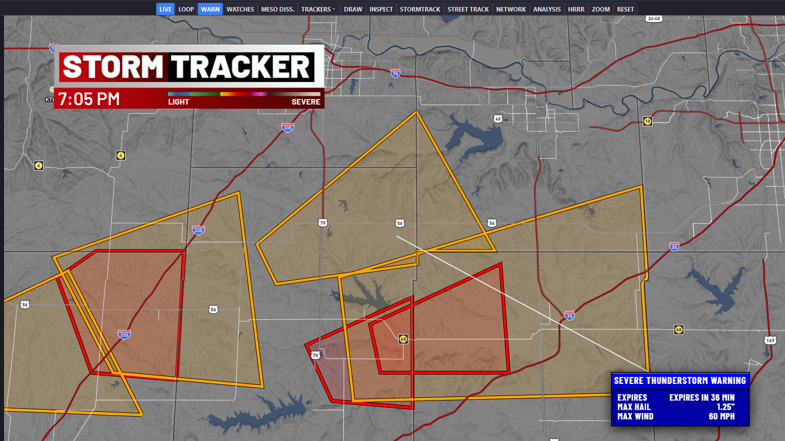
Live Tornado, Severe Thunderstorm, Flash Flood, and Flood warnings with color-coded polygons, click popups, expiry timers, and a sortable alerts list.
Real-time strike markers with age-based opacity on a native Mapbox GL symbol layer. LSR pings for tornado, hail, wind, and flood reports with magnitude & remark popups.
NWP Model Overlays
Vortex Viewer taps the UCAR THREDDS WMS feed for 49 HRRR products with a forecast-hour scrubber and fade-transition tiles. SPC Day 1 categorical outlooks (plus tornado / wind / hail) and active watch boxes overlay on demand.
TPI Engine
A three-layer composite that fuses environment, radar signatures, and gate-to-gate shear into a single 0–100 score per storm.
CAPE, CIN, SRH, bulk shear, and LCL heights pulled from RAP and HRRR via THREDDS.
Per-storm weighted composite of TVS, MESO, dBZ, VIL, and hail index signatures.
Gate-to-gate shear integration fused with Model TPI for a live 0–100 threat score. 13 km color-ramped grid overlay.
Broadcast Graphics
Bevel-and-emboss dark-blue panels with connector lines to map features. Draggable Storm / Shear / Warning / Hail / LSR / Spotter cards with automatic collision avoidance.
7-tier population-driven city labels with drop shadows, halos, tier-specific fonts, letter spacing, and zoom visibility curves. County, state, and country lines with live-preview setup.
Draggable QPainter QLabel overlay rendered at 2× resolution. Bottom-left by default, position persisted in QSettings, reused for loop playback.
Live storm-spotter position markers with info popups — know where trained eyes already are.
County-level outage fill polygons with click-through counts for post-storm impact assessment.
Programmatically generated 880 Hz triple-beep WAV via QSoundEffect, played before AI narrates a new warning.
Tech Stack
Vortex Viewer ships today. Start free, upgrade when you need the pro products.