§01 / The Stack
Every severe-weather product
operators need, in one app.
From raw Level II polar bins to ray-marched 3D tornado funnels, Vortex Viewer delivers a complete operator surface: radar, models, intelligence, and narration — wired together by a single event loop.
§ 01 — Rendering
VortexView 3D
Ray-marched volumetric cumulonimbus with self-shadowing, rotating wall clouds, SDF tornado funnels, dBZ-driven rain/hail shafts, and jagged 3D lightning.
- Multi-scale simplex noise turbulence
- Ground shadow projection
- WebGL2 custom fragment shader
§ 02 — Intelligence
Vortex AI
A Claude-powered storm analyst with Gemini TTS. Captures your radar, interprets it, focuses the map on the cell it's discussing, and narrates in broadcast cadence.
- Voice ducking on TTS
- Low-level rotation filter ≤ 6000 ft AGL
- Threat level: Monitor → Extreme
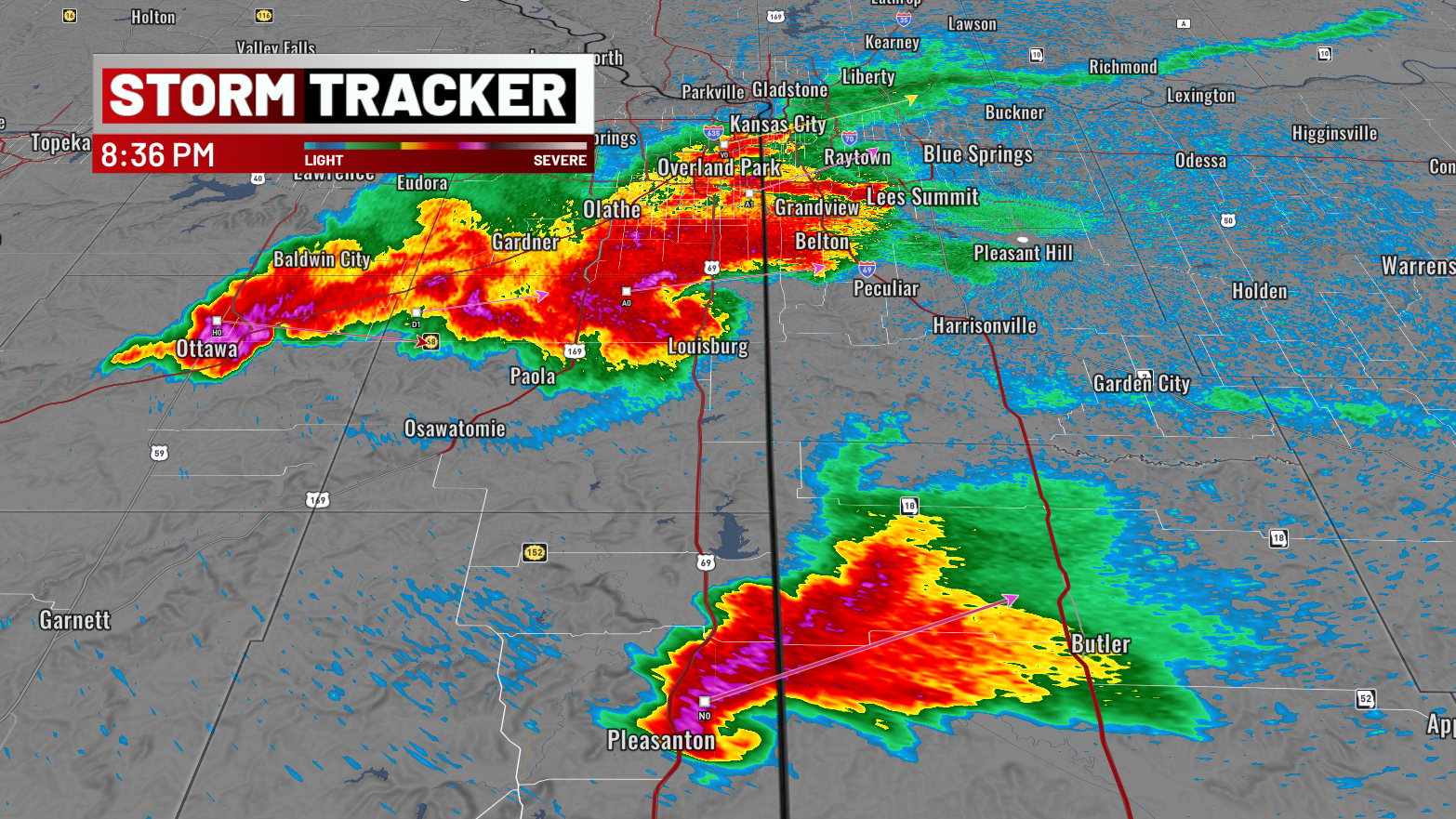
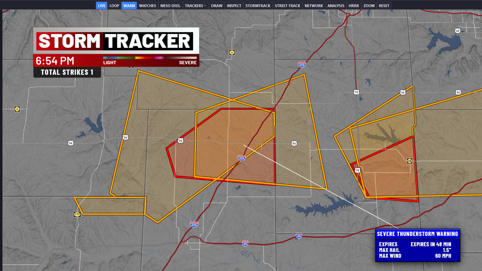
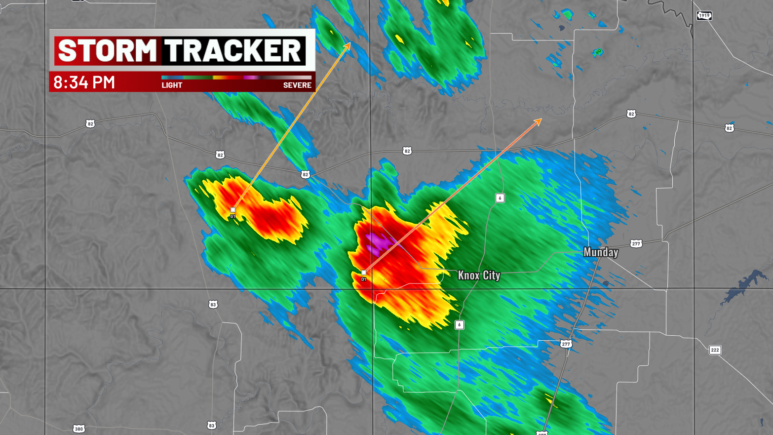
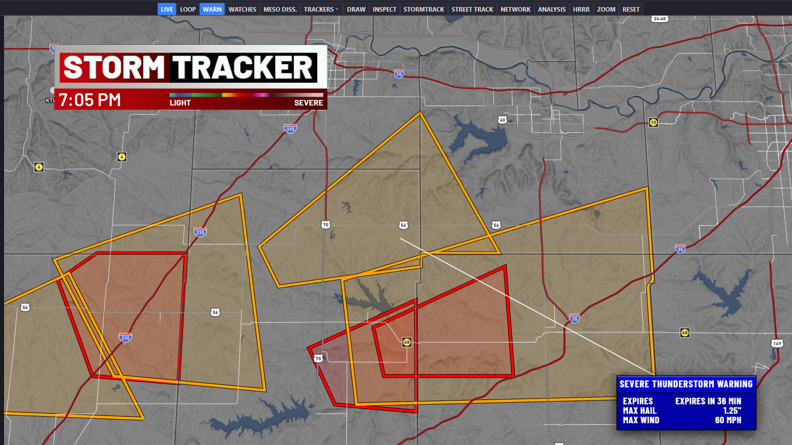
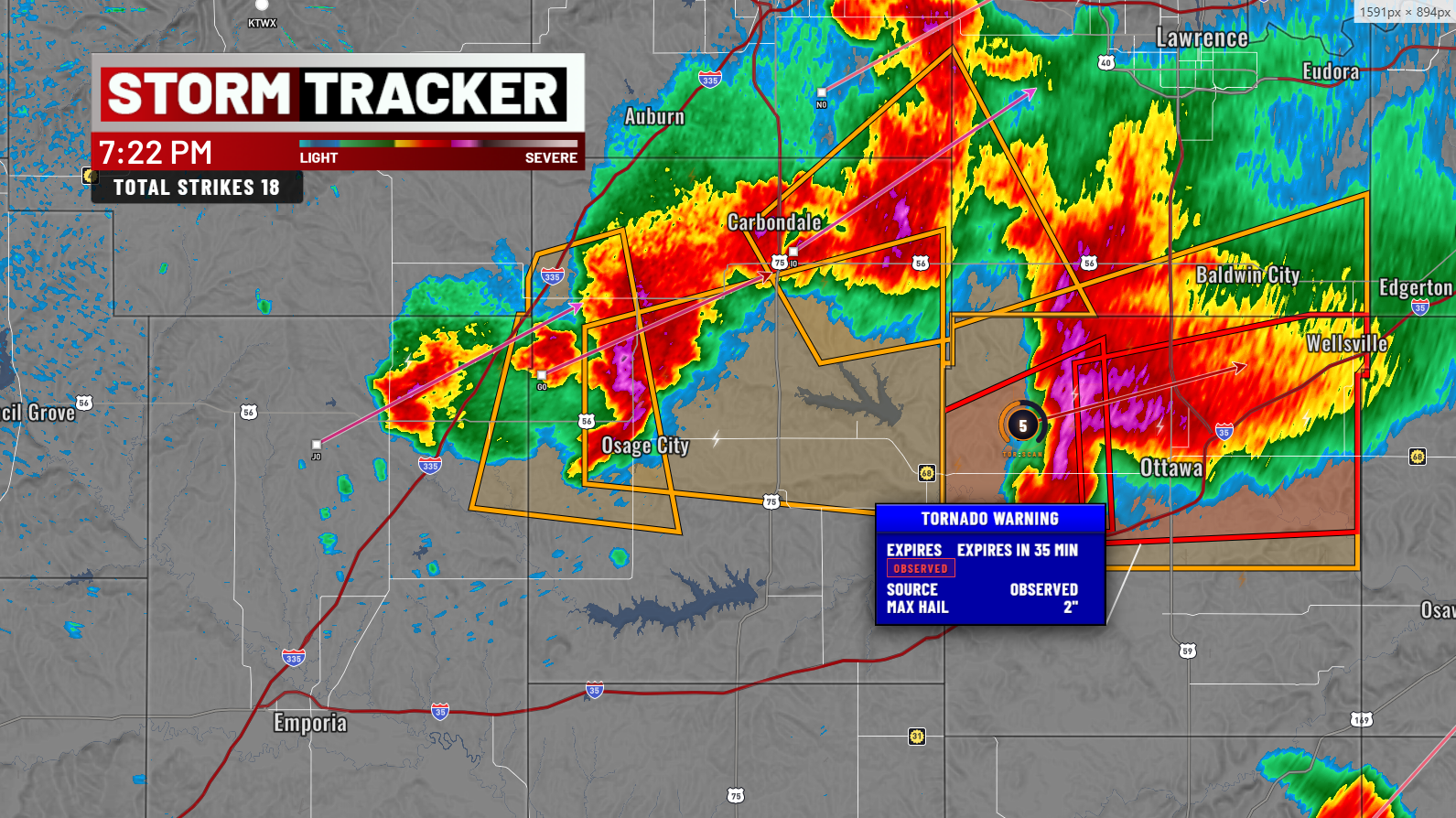
§ 03 — Severe
Level-3 Suite
NIDS decoding for SCIT, MDA, TVS, NHI — with motion vectors, past tracks, MESH labels, and Baron-style popups.
- Storm motion projection
- MDA rings with shear data
- Hail triangles & POH/POSH
§ 04 — Fusion
TPI Engine
Tornado Potential Index blending CAPE, SRH, shear from HRRR with per-storm TVS/MESO signatures into a single 0–100 score.
- Model + Radar + Enhanced modes
- Gate-to-gate shear integration
- 13 km grid overlay
§ 05 — Environment
NWP Models
49 HRRR products via UCAR THREDDS with a forecast-hour scrubber, plus SPC convective outlooks, watch boxes, and live Mesonet surface data.
- HRRR & RAP tile overlays
- SPC Day 1 categorical + tornado/wind/hail
- Oklahoma & Texas Mesonet stations
§ 06 — Graphics
Broadcast-Grade Output Layer.
Bevel popup panels with collision avoidance, a draggable QPainter scan-timestamp overlay rendered at 2× resolution, and a 7-tier GIS city-label hierarchy with halos, shadows, and zoom curves — the details that make the output feel on-air, not in-browser.